The Best Engineering and Survey company
25+
YEARS OF EXPERIENCE
At Sabaoth, we specialize in delivering professional land surveying and engineering solutions tailored to meet the needs of construction firms, developers, and government agencies. With a focus on accuracy, innovation, and reliability, our services support everything from site planning to infrastructure development and geospatial data analysis.

Why Choose Sabaoth?
- We extend our technical expertise into the Mining and Energy sectors
- Certified Survey Experts with years of field experience
- Use of advanced survey technology including drones, GIS & LiDAR
- Commitment to data accuracy and efficiency
- Customized solutions for every industry: construction, real estate, government, and agriculture.
What we do
At Sabaoth, we provide a comprehensive suite of Survey & Engineering Services that leverage the latest technology to deliver precise and actionable insights for your projects.

Land Surveying
We offer the best land survey services for residential, commercial, and industrial projects. Using modern surveying equipment like GNSS, Total Station, and drones, our licensed team ensures high-accuracy results.
Services include:
- Cadastral (boundary) surveys
- Topographic surveys
- Site layout & staking
- Construction surveys
- As-built surveys

GIS Mapping Services
Best GIS consultants to help you develop robust geographic information systems for asset tracking, urban planning, and land management. Visualize and analyze data for better decision-making.
Services include:
- GIS database creation & management
- Geospatial analysis & visualization
- Asset mapping
- Thematic and cadastral mapping
- Cadastral mapping

LiDAR Surveying
Sabaoth’s LiDAR survey services provide detailed 3D models and terrain analysis for large-scale infrastructure and environmental monitoring projects.
Services include:
- Corridor mapping
- Forestry analysis
- Infrastructure modeling
- Terrain analysis

Drone Surveying
With our aerial drone surveying services, we capture high-resolution geospatial data and imagery for faster, safer, and more efficient project execution.
Services include:
- Orthophoto generation
- 3D terrain modeling
- Volumetric analysis (stockpile measurements)
- Vegetation and environmental monitoring

Engineering Surveying
Our engineering survey solutions support civil engineering, road construction, and structural planning. We provide detailed data that guides infrastructure design and quality assurance.
Services include:
- Route and alignment surveys for roads and pipelines
- Earthworks and grading analysis
- Structural monitoring
- Utility mapping and verification

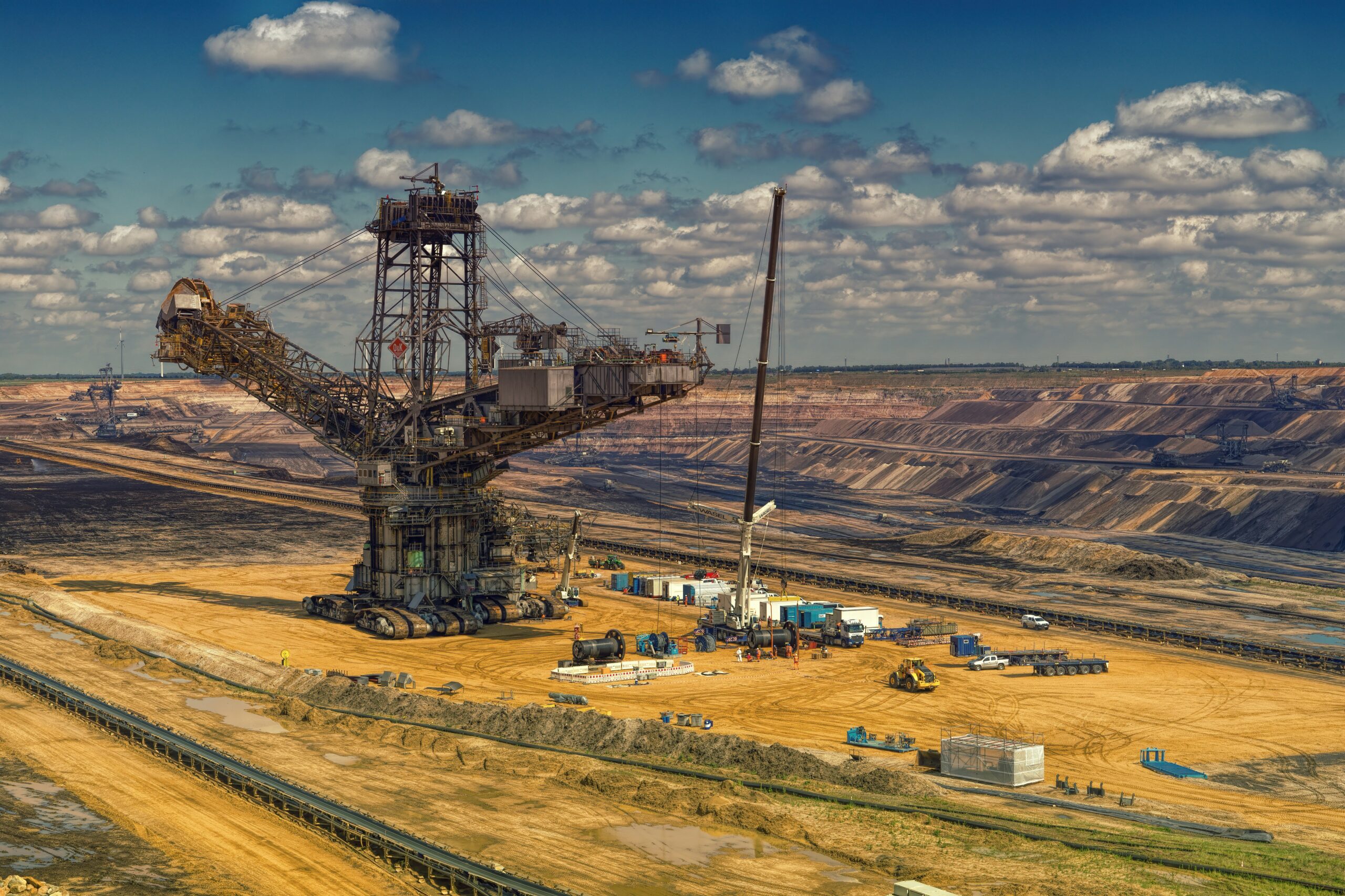
Mining and Energy Solutions
As part of our Survey & Engineering operations at Sabaoth, we extend our technical expertise into the Mining and Energy sectors. Our team provides geological and geotechnical surveys, resource mapping, and geo-spatial analysis to support mineral exploration, mining operations, and energy infrastructure development.
Services include:
- Topographical and mineral mapping
- Remote sensing and UAV (drone) surveying
- Geo-spatial data analytics
- Subsurface utility engineering
- Infrastructure layout for mines and energy plants
- Site selection and feasibility studies
Expertise
Happy Clients
Projects Completed
Reliability
Our services support various sectors, including:
- Government Bodies
- Construction & InfrastructureDevelopment
- Real Estate & Land Development
- Environmental Conservation
- Telecommunications
- Transportation & Logistics
- Agriculture & Forestry
- Energy (Renewable and Non-renewable)
Partner with Sabaoth for Your Next Project
Whether you need a topographic survey, drone mapping, or civil engineering support, Sabaoth is your trusted partner for survey and engineering services.